Each instance is customized to how and where your business operates. You're in charge of the metrics, lingo and dashboard layouts.
Intuitive Workflows
Create complete records with shapes, files and attributes. Link them via proximity or any defined relation in minutes. Point, click, drag, drop, go.
Mobile Friendly
Responsive design that adapts from an office PC to a mobile device out in the field. Get secure remote access to critical data and reports.
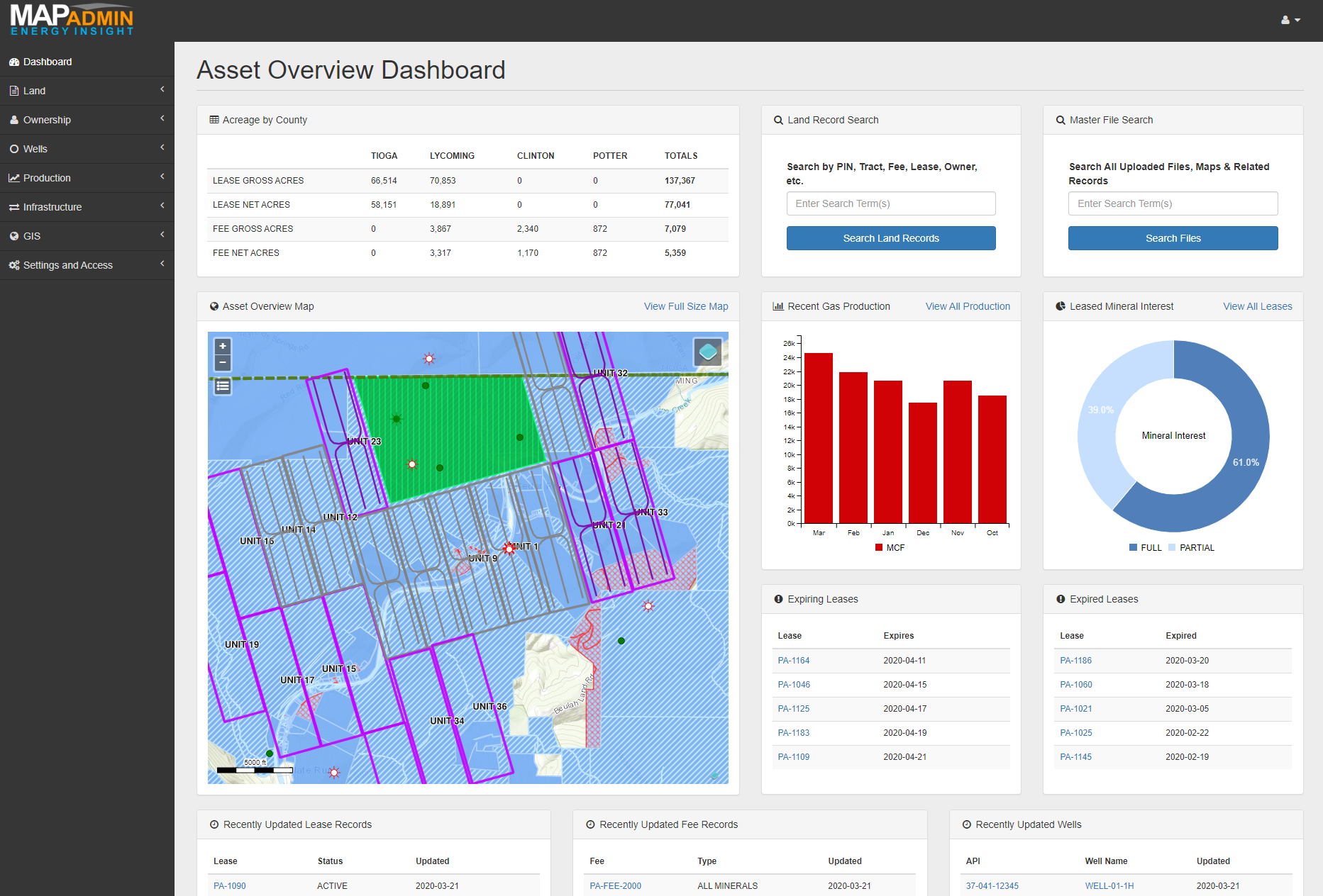
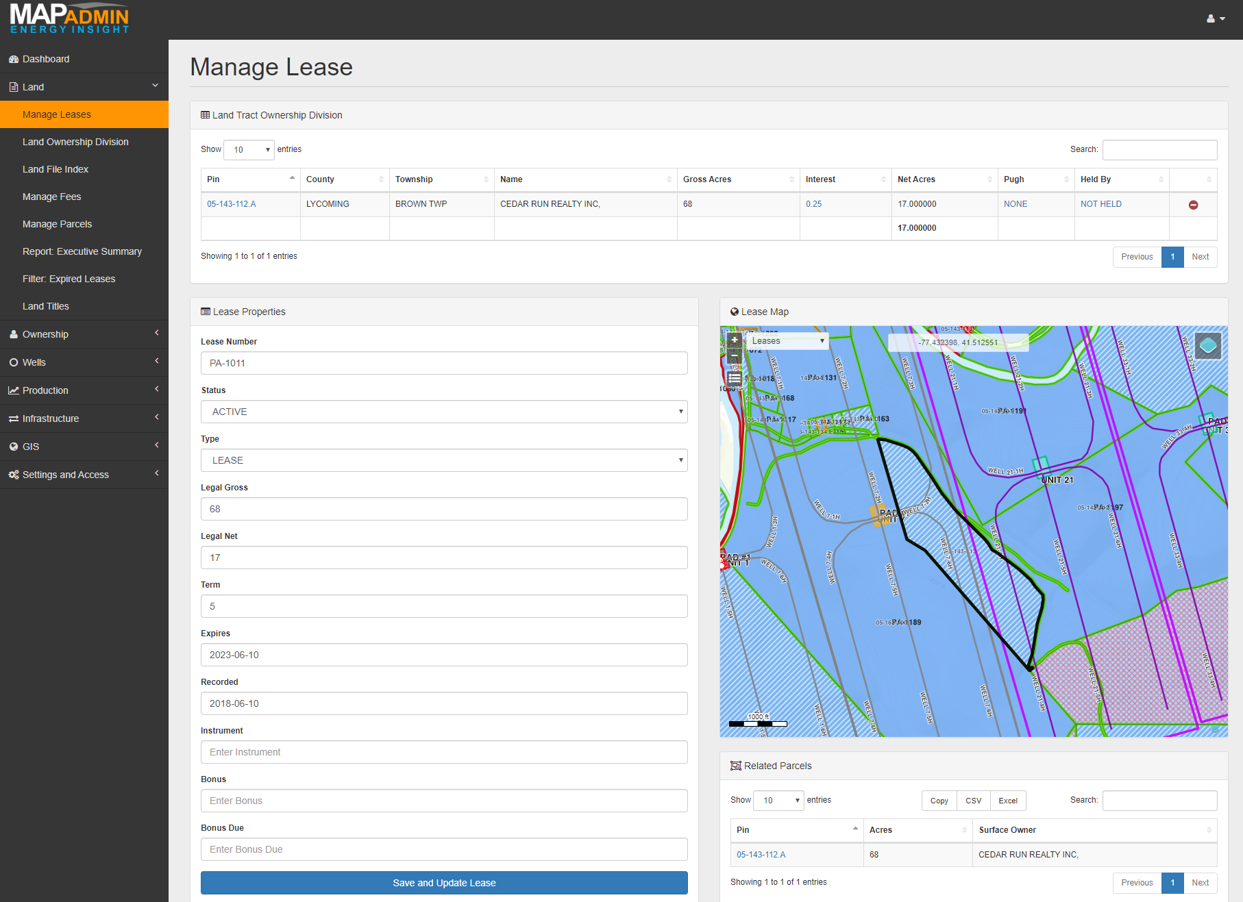
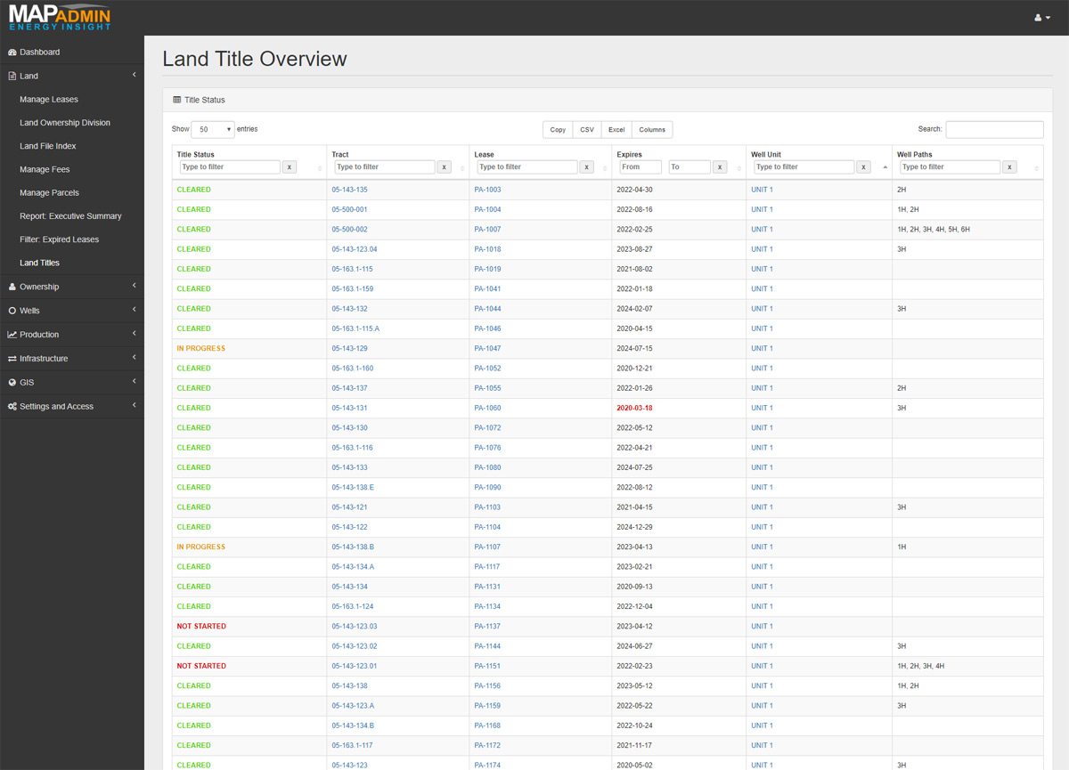
Land & Lease
Tools to manage nearly any type of land related record.
Previous
Next
Lease, Fee, Surface, Title and more
Manage different land types in the same place instead of bouncing between spreadsheets and file shares. Drag and drop all related land record files onto each record for fast intuitive retrieval.
Many to Many Relationships
Leases often have multiple owners with different interests, spread across multiple tracts, units, and well bores. We get that. Our solution lets your company define that relationship, which can vary by region and business.
Set a Reminder
Want to be notified of when a lease is about to expire? Or perhaps when a competitor well is permitted within so many feet of your acreage position? Gain an advantage with automated reminders connected to your spatial data.
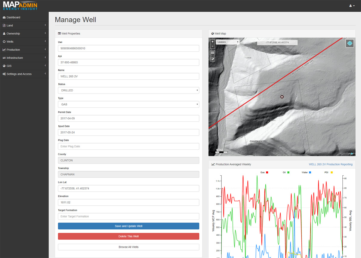
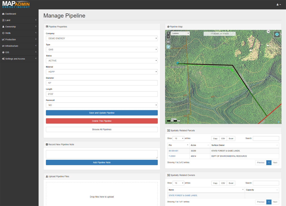
Wells & Production
Plan, track and report on wells and infrastructure.
Well Data Management
Track attributes and location data for wells, well bores, pads, units and related infrastructure. Upload permits, plats, logs, notes and any other related supported documents. All organized and managed on one page.
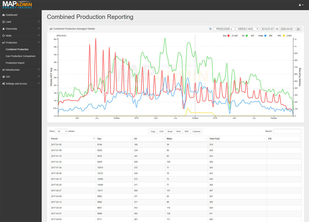
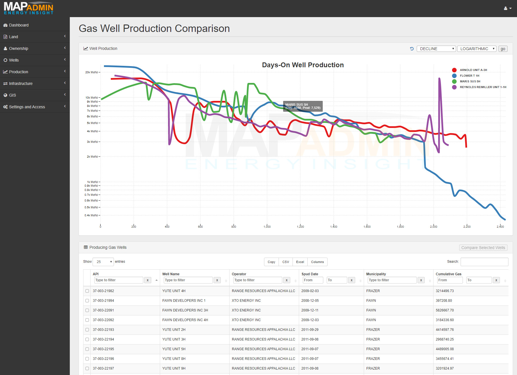
Production Reporting
Robust tools to plot and analyze well production data. Compare between company wells, to competitors or both. Interactive tables for filtering, sorting, reporting and exporting for both conventional and unconventional wells.
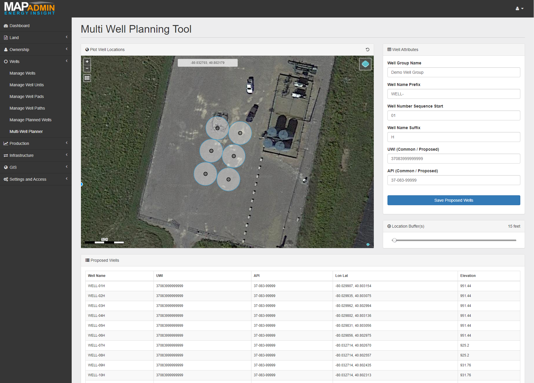
Well Planning Tools
Create groups of proposed locations with adjustable distance buffers over top of your asset layers and data points. Promote to a real world well with a single click once ready to be staked and permitted.
Previous
Next
Web Based Mapping
Powerful yet simple GIS tools, workflows and utilities.
Previous
Next
Create and Modify Shapes Online
Draw and modify locations, borders & boundaries right in your web browser. Save time and costs related to non-essential PC based GIS software licenses for basic edits and adjustments.
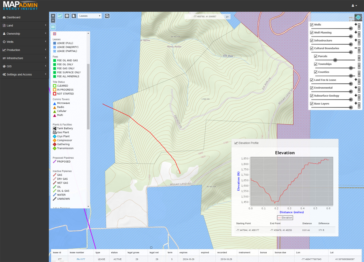
Build and Share Interactive Maps
Create a layer stack and zoom range that can be bookmarked and shared via a URL. Capture latitude, longitude, distance and elevation profile. Single click to select and manage features.
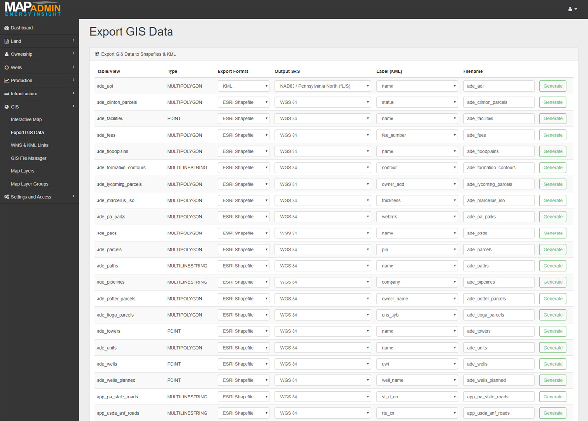
Integrate Existing GIS Resources
Import and export Shape-Files, KML and more. Connect directly to most popular GIS software including Google Earth, QGIS and ArcGIS. Publish or bring in WMS and WFS layers dynamically.
Custom Solutions
Software development doesn't have to cost a fortune. It's especially efficient when building on top of a platform like MapAdmin.
Build out only what you need rather than paying for an elaborate suite that you use a small fraction of. Hand pick these functionalities and we may be able to integrate them right into your MapAdmin deployment.
All for a reasonable one time expense rather than ever increasing licensing fees. Here are just a few examples of solutions that we've created for clients.
Automated export of IHS Markit Petra™ database and web based search, GIS and analysis tools.
Extend Enertia™ Software data points into a data-warehouse used for economic forecast modeling.
Map interface that displays color coded flow point meter status and anomalies using real time SCADA data.